July 2015

In July 2015, I took a 7 day cruise to Alaska on the Star
Princess. The ship left from Vancouver and finished in Anchorage (Whittier)
Alaska while stopping at 3 ports of call (Ketchikan, Juneau and Skagway). We
also spent the entire day cruising Glacier Bay National Park which for me was
the highlight of the cruise. If you are only to take one cruise in your life
then I highly suggest Alaska. This is one of the most beautiful cruises I have
ever taken. The scenery is spectacular as the ship navigates the inside passage
of British Columbia and Alaska passing small towns, dramatic mountains,
glaciers, remote wilderness areas and provides the cruiser with countless wildlife
sighting opportunities along the way. You’ll see humpback whales, orcas,
otters, bald eagles and sea lions right from the deck of the ship.
Day 1
After leaving Canada Place in Vancouver, the ship sailed
under the Lions Gate Bridge and pass Stanley Park into the Georgia Strait. The
following day (Day 2) we were at sea navigating through the Johnstone Strait
and passing the Queen Charlotte Islands towards southeast Alaska. On our day at
sea, I spent most of the time exploring the ship and participating in the many
activities offered throughout the day.
 |
| Cruise ship terminal at Canada Place in Vancouver |
 |
| The Star Princess leaving Vancouver and sailing past Stanley Park |
Day 3
We docked in the small town of Ketchikan in the early
morning. We spent roughly 6 hours there.
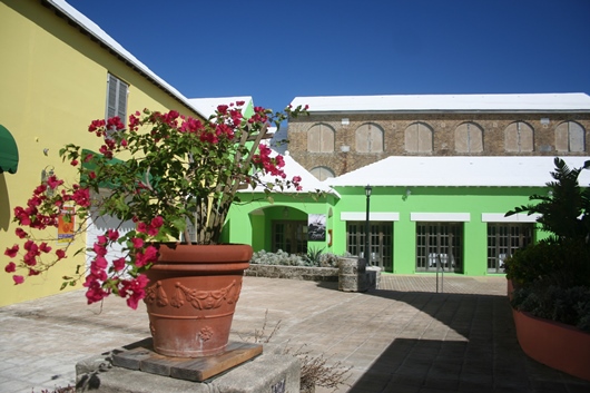
Ketchikan is a very small Alaskan town famous for its
collection of totem poles. It has also been dubbed the “Salmon capital of the
World”. When we arrived it was raining quite heavily. Ketchikan is situated in
a temperate rainforest and gets a lot of rain due to its geographic location. In
fact, they get around 160 inches of rain per year so the chances are pretty
high that during a visit to Ketchikan, it will be raining.
Because of the rain, I opted to do a self-guided walking
tour of the town. There is a Historic Walking Tour map which is available at
the visitor centre which outlines a 2 hour walking route of places of interest.
This walking tour passes by several totem poles, Creek Street (which is a
former red light district) and a salmon ladder.
In mid-afternoon, we departed the port of Ketchikan making
our way north via the Tongass Narrows and through the straits of Southeast
Alaska towards our next destination, Juneau.
 |
| Creek Street, Ketchikan |
 |
| Totem pole in the town of Ketchikan |
Day 4
In the early hours of the morning the ship entered and
docked in Juneau Harbour. Juneau is the state capital of Alaska and it is
situated in some of the most rugged terrain. The Juneau Icefield which is
located above the town is a massive accumulation of ice and snow stretching for
hundreds of miles. Because of this, Juneau is definitely the best location on
the cruise itinerary for flightseeing.
This was a long day as we spent almost 13 hours in Juneau
providing ample opportunities for sightseeing and adventure activities.
In the morning as soon as I got off the ship, I purchased
round-trip transportation on a shuttle which dropped me off at the Mendenhall
Glacier. This allowed me to stay as long as I liked. I spent roughly 4 hours
exploring the visitor centre and hiking the many numerous trails around the
glacier. These trails which vary in distance and challenge bring you up close
to cascading waterfalls, salmon streams, and rainforests laden with moss.
The Mendenhall Glacier which is part of the Juneau Icefield
is located in Tongass National Forest only a short distance from Juneau. This
glacier which is 13.6 miles long is currently in a state of retreat and
terminates on the far side of Mendenhall Lake.
 |
| Mendenhall Glacier |
 |
| Trail of Time is a short trail at Mendenhall Glacier |
 |
| Waterfall found on the Trail of Time hiking trail |
After returning in the afternoon from my Mendenhall Glacier
visit, I took a whale watching tour. Apparently, Juneau is one of the best
places in the world for whale watching. I certainly was not disappointed as I
had the opportunity to view several humpback whales at close range.
We departed later in the evening making our way through the
Gastineau Channel to our next destination, Skagway.
Day 5
Once again in the early morning, the Star Princess made her
approach to historical Skagway, the gateway to the Klondike. Skagway is a
little town with a population of less than 1000 although it usually swells
during the summer months primarily due to visitors from the cruise ships.
Skagway’s main reason for being is essentially the Klondike Gold Rush. In the
late 1800s gold was found in the Yukon Territory of Canada and Skagway became a
great access point for those who prepared for the long journey to the Canadian
gold fields.
Today the small town
has a historical district with many buildings that remain from the gold rush
era. While a lot of passengers from the cruise ship usually book the Yukon
White Pass Railroad Tour, I opted to take a bus tour with a local tour operator
in town. This tour which essentially follows the entire path of the train along
the Klondike Highway costs a fraction of the price and stopped at many scenic
viewing areas. We stopped at waterfalls, alpine lakes and even spotted mountain
goats on the precipitous cliffs along the road.
Upon my return in the afternoon, I decided to do a short
hike to Yakutania Point and Smuggler’s Cove.
We departed later in the evening making our way to our next
destination, Glacier Bay National Park.
 |
| Along the Klondike Highway in Skagway |
 |
| Skagway, Alaska |
 |
| Smuggler's Cove |
Day 6
At 6.00 am we entered the entrance to Glacier Bay National
Park at Bartlett Cove where national park rangers boarded the ship from a speed
boat that docked along the ship. We spent close to 9 hours touring this
beautiful national park as the park rangers provided us with commentary.
Glacier Bay is one of the most remote parks in the US
National park system. The only way to reach it is either by plane or boat as
there are no roads that lead into the park. Despite this, the park receives
over 400,000 visitors per year, the majority (80%) arriving via cruise ship.
To say the least, Glacier Bay is absolutely spectacular. It
is comprised of 3.3 million acres of mountains, glaciers, forests and waterways
making it the definite highlight of the Inside Passage. It’s hard to believe
that just over 250 years ago, Glacier Bay wasn’t even a bay but once was a
massive river of ice roughly 100 miles long and thousands of feet deep. Today a
few tidewater glaciers remain mostly in the upper bay.
Upon entrance at Bartlett Cove, our ship travelled another
55 miles to get to these tidal glaciers.
We arrived at Lamplugh Glacier at
around 9:30AM. We stayed in the area visiting Lamplugh Glacier, John Hopkins
Glacier and Topeka Glacier for around 1 hour and a half before departing for
Margerie and Grand Pacific Glaciers. Once at Margerie Glacier, we spent another
hour admiring the beauty of the glacier with its deep blue tones as the ship
repeatedly turned on a dime 360 degrees allowing for a panoramic view of the
entire area.
We left Glacier Bay at around 3:30PM for our next
destination College Fjord.
 |
Margerie Glacier, Glacier Bay National Park, Alaska
|
 |
| John Hopkins Glacier, Glacier Bay National Park, Alaska |
 |
| Topeka Glacier, Glacier Bay National Park, Alaska |
 |
| Lamplugh Glacier |
Day 7
The Star Princess sailed into Prince William Sound to view
the majestic College Fjord. College fjord contains several tidewater and valley
glaciers which are named after several elite US East Coast Colleges.
As you travel through the fjord you are surrounded by
towering snow covered and rocky peaks. Like Glacier Bay, College Fjord is also
one of the best glacier viewing spots in Alaska. There are five tidewater
glaciers in the fjord, Harvard Glacier being the largest with a 2kms wide face
and 300 ft thickness.
After leaving college fjord we made our way to Whittier our
final destination and port of disembarkation.
A magnificent Alaskan cruise had come to an end but the
memories of what I had seen and experienced will always remain with me.
 |
| Star Princess sailing through College Fjord towards Harvard Glacier |
 |
| Harvard Glacier, College Fjord, Alaska |
 |
| View of Harvard glacier (left) and Yale glacier (right)
as the cruise ship leaves College Fjord |