Saturday, September 29, 2007

Badlands Scenic Drive, Badlands National Park, South Dakota

September 2007

If I had to use two words to describe Badlands National Park, they would be "lunar landscape". As I was driving through the park, certain areas made me feel like I was on the moon.

The Loop Drive through Badlands National Park is certainly one of the most beautiful and scenic drives in South Dakota. I started the drive at the Northeastern Entrance on my way to Mount Rushmore. You can also do the drive in reverse starting in the town of Wall and entering though the western Pinnacles Entrance. Along the way, there are many spectacular overlooks such as the Pinnacles Overlook, Panorama Point, and Yellow Mounds to name only a few.

Canyons, towering spires, flat-topped tables, prairie and grasslands dominate the park landscape. The park is quite large covering an area of 244,000 acres. Scientist believe this area was once a large watering hole some 33 million years ago very much similar to the watering areas in Africa. The park also has one of the world's richest mammal fossil beds.


Badlands National Park
Door Trail, Badlands National Park

The Door Trail is a short boardwalk trail that leads through an opening in the Badlands Wall ("the Door") and offers expansive views of the arid and rock landscapes of the Badlands.

Badlands National Park
Cliff Shelf Trail, Badlands National Park


Cliff Shelf Trail consists of a boardwalk and stairs and climbs 200 feet though a juniper forest.


Badlands National Park


Badlands Visitor Center is located close to the Northeast Entrance of the park. It features exhibits and a movie called Land of Stone and Light which provides visitors with a good introduction and understanding of the park.

Badlands National Park
Panorama Point Overlook, Badlands National Park.


Two geological processes were at play in this park over many million of years, deposition and erosion. The process of erosion started 500,000 years ago and continues today as water cuts through the rock layers carving incredible shapes.

Badlands National Park

Badlands National Park


Badlands National Park


Badlands National Park
View of Sage Creek from Yellow Mounds Overlook


Badlands National Park
Deep eroded canyons are a common feature in Badlands National Park

Badlands National Park
Pinnacles Overlook


Pinnacles Overlook is the highest point in the park at 3,247 feet or 1,009 meters located near the western Pinnacles Entrance close to the town of Wall.


Badlands National Park

Saturday, September 22, 2007

Mount Rushmore, South Dakota

September 2007

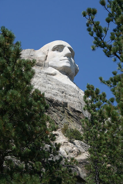
Mount Rushmore is a beautiful work of art which is sculpted out of granite. It is a true testament to the American Dream. The Sculptor Gutzon Borglum first began the creation of the National Memorial in 1927. The sculpture was unveiled 14 years later at a cost of $1 million. Mount Rushmore is located in the Black Hills in the state of South Dakota. It receives 3 million visitors per year from all corners of the globe.

Here are a few more interresting facts about Mount Rushmore. Did you know?
- 90% of the Memorial was carved by using dynamite
- Mount Rushmore is eroding 1 inch every 10,000 years
- Originally the figure of Thomas Jefferson was started on Washington's right. Due to fissures in the mountain, it had to be restarted on the left of Washington.
But you'll learn all these things while you visit Mount Rushmore's impressive Interpretive Centre where you can watch a movie and see numerous exhibits depicting how the Memorial was built.

You'll pass the Avenue of the Flags as you make your way from the Concession Building to the Grandview Terrace. There are 56 flags representing 50 states, one district, three territories and two commowealths of the United States. The flags are arranged in alphabetical order. From the Grandview Terrace, you will get a fantastic view of all four Presidents. Looking below is the Amphitheater where an Evening Sculpture Lighting Ceremony takes place each evening during the summer.


Mount Rushmore
Mount Rushmore as seen from Grandview Terrace

The faces of the 4 Presidents from left to right:George Washington,Thomas Jefferson,Theodore Roosevelt and Abraham LincolnFrom the Grandview Terrace, you can access the Presidential Trail, a 0.5 mile trail that brings you though a forest of pine and offers great up-close views of the Presidents.

Mount Rushmore is a must see. There are lots of places to visit in the surrounding area so plan accordingly.

Mount Rushmore
 
Mount Rushmore
 

Mount Rushmore


Friday, September 7, 2007

Devil's Tower, Wyoming


September 2007


Devils Tower also known as Grizzly Bear Lodge is a unique rock formation that is situated in northeastern Wyoming near the Belle Fourche River. Actually, it's the core of a volcano exposed after millions of years of erosion. It was designated by President Theodore Roosevelt in 1906 and became America's first National Monument. Devils Tower is 864 feet high as measured from its base and is a favorite with rock climbers. You don't fully realize how huge this structure is until you get a glimpse of a rock climber scaling it.

I stopped off at the Tower while I was on my way from South Dakota to Yellowstone National Park and spent some time exploring the area. There is a trail (1.3 mile, 2km) that circles the Tower that allows close-up views and the opportunity to learn about the geology of the surroundings though many interpretive signs.

The 1,347-acre park which is covered with pine forests, woodlands, and grasslands is considered by Native Americans as a sacred place for prayer and renewal. In fact, while you're walking around the site, you'll see colorful cloths tied to trees that have been left behind. These prayer cloths and bundles are offerings containing tobacco, sweet grass and cedar that visitors are advised to not remove. While walking around the Tower, you'll also see bald eagles and ravens soaring on the thermals high above.

Devils Tower was also featured in the Steven Spielberg movie Close Encounters of the Third Kind.

Devil's Monument
 

Monday, July 30, 2007

Waterton Lakes National Park, Alberta

July 2007

Waterton Lakes National Park is located in the southern part of Alberta on the border with Glacier National Park in Montana. This is a beautiful park composed of rugged mountains, prairies, lakes and subalpine forests. It is a great place for hiking with hundreds of  kilometers of trails. While I was there I hiked several trails including Bear's Hump, Forum Lakes, Red Rock Canyon and Carthew Alderson Trail.


waterton lakes national park
Panaramic view of Waterton Lakes from Bear's Hump

waterton lakes national park
Prince of Wales Hotel

waterton lakes national park

waterton lakes national park
Waterton Lakes view from Prince of Wales Hotel

forum Lake, bc
Forum Lakes, BC is a half day hike from Waterton Lakes

waterton lakes nationa park, carthew alderson
Carthew Alderson Trail

waterton lakes nationa park, carthew alderson

waterton lakes nationa park, carthew alderson
Carthew Alderson is an amazing hike which starts at Cameron Lake and ends at Cameron Falls. It offers spectacular views.

On my way from Banff National Park to Waterton Lakes I stopped at the Bar U Ranch and Head-Smashed-in-Buffalo-Jump.

The Bar-U Ranch is situated in the Foothills of Southern Alberta near Longview on Highway 22 (also known as the Cowboy Trail). From 1882 to 1950, the Bar U was one of the largest and most successful corporate ranches in Western Canada. Today, it is a National Historic Site consisting of over 30 historic buildings and a modern visitor orientation centre that illustrates the functionings of a typical western ranch.

You can wander the site either on foot or take a wagon ride pulled by two of the famous Bar U Percherons. Learn how to lasso a calf from a professional cowboy and sit by a camp fire and chuck wagon at Roundup Camp enjoying some fired brewed coffee and eating freshly made bannock.

There are many other interpretive buildings to explore on the premises such as the Bar U Post Office, cookhouse and stables.      
The ranch which is situated roughly 100 kms south of Calgary is well worth a visit and makes for a great day trip from Calgary. This is also great stop for those who are going to or coming back from Waterton Lakes National Park.
Bar U RAnch
View of Bar-U Ranch and Canadian Rockies in the distance


Head Smashed in Buffalo Jump
Head-Smashed-in-Buffalo Jump is around 300 meters long and 10-18 meters high.


Head-Smashed-in-Buffalo-Jump is one of the world's largest and best preserved buffalo jumps located in the Porcupine Hills of southwestern Alberta. It was designated as a UNESCO World Heritage site in 1981. There is an impressive interpretive centre and museum which is built and blends into the ancient sandstone cliff. The centre is composed of 5 levels which depict the history and culture of the Native Americans.
Native people of the North American plains (The Blackfoot) used a creative strategy of rounding up the bison and chasing the herd down drive lanes lined with more than 500 stone cairns over a precipice. This began nearly 5,500-6,000 years ago and continued into the middle of the 19th century. After being killed due to the fall from the cliff, the dead carcasses were processed at a nearby camp. The bison provided the Native People of the Great Plains with food, hides for clothing and shelter, sinew, and bone for tools.
Head-Smashed-in-Buffalo-Jump is situated 18 kms west of Fort Macleod and roughly 180 kms south of Calgary. This is a great stop for those who are going to or coming back from Waterton Lakes National Park.


Plains of the Six Glaciers Hike,Lake Louise, Banff National Park, Canada

July 4, 2007

Along with Lake Ages, another popular trail in the Lake Louise area is the Plains of the Six Glaciers Trail. This trail brings you to the toe of the spectacular Victoria Glacier. As with Lake Agnes, there is also a tea house where you can rest and sample some of the delicious home-baked treats.

The trail head begins on the shoreline to the far right of Chateau Lake Louise. It follows the lake shore trail to the far end of the lake. It continues past the inlet creek that feeds Lake Louise and eventually emerges through the trees into a rocky terrain which ultimately leads to Victoria Glacier. There are many sites to enjoy along the way such as glaciers, moraines, avalanche paths and a variety of alpine wildflowers.

plains_six_glaciers_hike
Six Glaciers Avalanche Path- A good place to spot mountain goats.

plains_six_glaciers_hike

Hiker on Six Glaciers Trail.


plains_six_glaciers_hike
A view of Lake Louise, Chateau Lake Louise and Lake Louise Ski Hill from the Six Glaciers Trail. 

plains_six_glaciers_hike, Lake Louise


plains_six_glaciers_teahouse, Lake Louise
Six Glaciers Teahouse built in 1924 by Canadian Pacific Railroads for Swiss mountain guides.
Victoria Glacier, Lake Louise , Banff National Park
Close-up of Victoria Glacier.

Consolation Lake Hike, Banff National Park, Canada

July 14, 2007

The trail for Consolation Lake starts at Moraine Lake. It's a short easy trail that offers spectacular scenery. The hike is roughly 3 km one way and has an elevation gain of 65m. It takes around 1.5 to 2 hours. Other hikes starting at Moraine lake include Larch Valley, Sentinel Pass, Eiffel lake, Wenkchemna Pass, and the Rockpile.

Consolation Lake, Banff National Park

Consolation Lake, Banff National Park

Consolation Lake, Banff National Park

Consolation Lake, Banff National Park

Larch Valley and Sentinel Pass Hike,Banff National Park, Canada

July 6, 2007

One of the most beautiful hikes in the Lake Louise area is Larch Valley and Sentinel Pass. The trail head for Larch Valley begins in Moraine Lake just a short distance from Moraine Lake Lodge. It is well indicated.
Be aware, this area is prime black and grizzly bear country and Parks Canada puts up bear warning signs at the trail heads when there is evidence that a bear is in the area.

The trail steeply ascends through a dense forest with occasional glimpses of Moraine Lake. After climbing for several kilometers, the trail finally emerges into an open meadow with a stream. This is called the Larch Valley. It is a very popular area in the fall when the larches turn a magnificent golden colour. I took a well deserved rest here and ate my lunch.

Larch Valley, Banff National Park


Sentinel Pass, Banff National Park
On the way to Sentinel Pass
The trail continues to make it's way through the valley until it finally passes the last trees. At this point, Sentinel Pass is clearly visible. As you continue on, you'll pass some lakes and begin to climb a series of streneous and very steep switchbacks to Sentinel Pass. The views from either side of the pass are simply incredible.On one side, from the direction that you came, a magnificient view of the Valley of the Ten Peaks and on the other side, a view of Paradise Valley.

Sentinel Pass, Banff National Park
A series of very steep switchbacks leads to Sentinel Pass situated at 2611m elevation
Sentinel Pass, Banff National Park

Valley of Ten Peaks
View of Valley of the Ten Peaks from Sentinel Pass


Paradise Valley
View of Paradise Valley from Sentinel Pass


Lake Agnes Hike, Banff National Park, Alberta

Lake Agnes is one of the most hiked trails in the Canadian Rockies because of its location and accessibility. It is a magnificent half-day hike that offers many stunning views especially if you push on to the Little and Big Beehives Viewpoints.

The trail head begins on the shoreline to the far right of Chateau Lake Louise. It is well indicated by several signs. The trail makes it's way through an old growth forest of spruce and fir trees and ascends through a series of switchbacks to Lake Agnes. Half way up the trail, you will begin to see glimpses of the turquoise colors of Lake Louise.

You'll come upon Mirror Lake less than 1 km from the tea house. This offers a nice place to rest and a great view of the Big Beehive.

Mirror Lake and the Big Beehive


The final ascent to Lake Agnes and the Teahouse passes a series of beautiful waterfalls called Bridal Veil Falls.


Lake Agnes, Banff National Park


Lake Agnes Teahouse a wonderful place to have a bite to eat and to try a varied assortment of teas and beverages.


Looking towards the teahouse- Lake Agnes far end of the lake.
From the tea house you have several choices. 1)You can return the way you came 2)Hike to the Little Beehive or the Big Beehive. My favourite, the Big Beehive brings you along the shores of Lake Agnes to the far end of the lake. A series of tight switchbacks begins making your way up to the Big Beehive. The Big Beehive offers great views of Lake Louise and the Chateau as well as a expansive view of the entire valley.


Photo Description: View looking backwards while heading to the Big Beehive.


Photo Description: View of Lake Louise from the Big Beehive Viewpoint.


Instead of turning around from the Big Beehive and heading back the same way to the teahouse, you can follow the trail that leads to the Six Glaciers trail for a full day hike. The Six Glaciers trail will also bring you back to Chateau Lake Louise.


Wednesday, May 30, 2007

Angels Landing Hike, Zion National Park ,Utah

April 2007

Angels Landing is a popular and spectacular day hike which is located in Zion National Park, Utah. This is not a hike for everyone especially for those who are fearful of heights. A good portion of the trail is paved and is very busy during peak times. The last portion of the trail follows a narrow ridge with steep-drop offs. There are anchored support chains to assist hikers to the summit.
From the summit, there are magnificent views up and down the valley with the Virgin River winding its way into the distance. Landmarks such as the Great White Throne and Big Bend can be seen from this viewpoint.

Angels Landing stands at elevation 5990 feet and is a 5 mile round trip hike.

Here are a few pictures from my hike.

Angel's Landing
Angels Landing from the Grotto trail head and valley floor.


The final ascent to Angels Landing- Warning: For the brave only! This is the section that has the chains for safety and guidance. In certain areas, the ridge is only a few meters wide with very steep drop-offs of close to 1200 feet on one side and 800 feet on the other.


Angels Landing, Zion National Park, Utah
Chains en route to summit of Angels Landing

Angels Landing, Zion National Park, Utah
View of Big Bend from Angels Landing


Angels Landing, Zion National Park
View of Zion Canyon from summit of Angels Landing
Angels Landing, Zion National Park, Utah
Angels Landing looking towards Virgin River Valley